

")


")
")
Germany, an 1838 folding map of the area and bordering states.
£95.00
Schmidt, J, M[arius] F[riedrich]: Post Karte von Deutschland und den angenzendenStaaten in 4 Blättern von Professor J. M. F. Schmidt. Simon Schrott et Comp. Berlin 1838.
A large engraved map, hand coloured in outline. dissected, linen mounted and 37 x 38½ ins [ 94 x 98 cm] extended, folding down to 9½ x 5 ins with publisher’s printed label with contemporary manuscript Matthw. Hadow Williamson, Berlin 1839 . There is a little curling to the top of the upper endpaper and a few few splits along the linen of folds but the map is in decent condition for its age. It includes the whole of Germany and its states and extends to the south of Europe as far as Naples, into France in the west, Russia in the east and north to the Baltic coast. jul23/1
1 in stock
Related products
-
Sale!
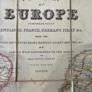
A post map of Europe including England, France, Germany, Italy. &c. Mid 19th century
£120.00£100.00 Add to cart -
Sale!

Map of Austria from the Napoleonic period, dated1814
£400.00£350.00 Add to cart -
Sale!

Champagne and Brie. A large two sheet French map by Bazin, 1790.
£230.00£200.00 Add to cart -
Sale!
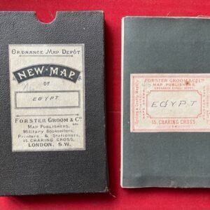
Egypt, Arabia Petraea. A late 19th century folding map.
£90.00£75.00 Add to cart