


")

")
NORTH INDIA. A folding map of the 1880s
POA
Hughes, W., F.R.G.S.: India. North sheet. On a scale of 69.15 English miles to 1 inch. George Philip [London & Liverpool] no date but probably 1880s.
Folding coloured map, dissected, linen mounted, extending to 26 x 22 ins and folding down to 7 x 5 ins, retaining only the rear blue cloth covered board, some splits along part of the linen of two fols but generally in very decent condition. The map extends from a little way south of Aurungabad in the Bombay Presidency in the south to the Pamir Steppes with the area above the northern border of India uncoloured and from Kurachee in the west to Tipperah in the east. jul22/1 SOLD 13th November 2025
Available on backorder
Related products
-
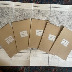
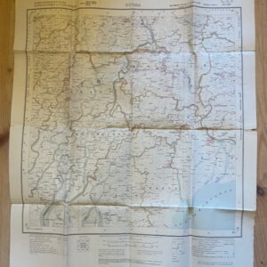
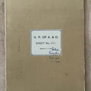
United Provinces of Agra & Oudh. Six large scale folding maps of Almora District. c.1870s/80s
£160.00 Add to cart -
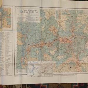
SHIMLA. A large scale guide map. surveyed in 1968
£35.00 Add to cart -
BURMA. Folded paper map No. 85 P MA-UBIN Survey of India 1926
£20.00 Add to cart -
NAINI TAL & GARHWAL 1 inch map of 1894 in use by a hunter in the 1940s
£55.00 Add to cart